When I first looked into the Bali Pass Trek, the big question I had was: How far is it, really? I wasn’t looking for poetic descriptions or vague ideas. I wanted numbers, a clear breakdown of what I’d be walking each day, and a realistic sense of the challenge. So if that’s what you’re here for, let’s get straight into it.
Trek Snapshot
-
Starting Point: Taluka (reachable by jeep from Sankri)
-
End Point: Janki Chatti (near Yamunotri)
-
Total Distance: Approx. 60 to 66 km
-
Highest Point: Bali Pass – 4,950 meters
-
Trek Duration: 6 days of trekking (usually part of an 8-day plan)
Day-by-Day Trek Distance and Elevation
Day 1 – Arrival at Sankri (No Trekking)
You’ll drive from Dehradun to Sankri (200 km, 8-10 hours). No trekking here, just a rest day at 1,950 meters. Make the most of it—hydrate, relax, and get ready.
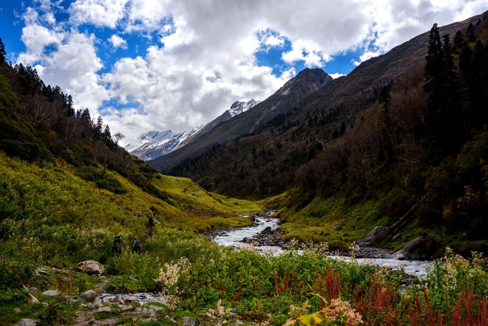
Day 2 – Taluka to Seema (~12-14 km)
From Sankri, a jeep drops you at Taluka (2,080 m). The trek kicks off from here. The trail to Seema (2,700 m) is lush, green, and follows the Supin River. It’s a moderate trail, but it gets long. Expect a 6-8 hour hike.
-
Distance: 12-14 km
-
Elevation Gain: ~600 m
-
Toughness: Easy to moderate
-
My Tip: Don’t rush. This day sets the pace for your body to adapt to trekking daily.
Day 3 – Seema to Rain Basera (~10 km)
Here, things start to feel remote. The forests thin out, and the terrain turns rocky. The gradient gradually increases. You’re now heading toward alpine terrain.
-
Distance: ~10 km
-
Elevation Gain: ~500 m (up to 3,200 m)
-
Toughness: Moderate
-
My Tip: You’ll start feeling the altitude. Sip water often and keep your body warm.
Day 4 – Rain Basera to Ruinsara Tal (~7 km)
This is where the scenery really hits you. Meadows, alpine flowers, and finally the stunning Ruinsara Lake. You’ll camp near the lake at about 3,600 meters. The distance is shorter, but take it slow—the altitude is catching up.
-
Distance: ~7 km
-
Elevation Gain: ~400 m
-
Toughness: Easy on legs, but altitude can make it harder
-
My Tip: Take lots of photos. This is one of the most beautiful campsites in Uttarakhand.
Day 5 – Ruinsara to Odari (~4 km)
Today is all about acclimatizing and preparing for the big day ahead. Odari, at about 4,100 meters, is a basic campsite. Short in distance, but not in effort.
-
Distance: ~4 km
-
Elevation Gain: ~500 m
-
Toughness: Moderate due to thinner air
-
My Tip: Don’t sleep in late. Get used to early alpine starts.
Day 6 – Odari to Lower Dhamni via Bali Pass (~14 km)
This is the longest and toughest day. You’ll begin trekking before sunrise to hit the Bali Pass summit (4,950 m) when it’s still safe. From there, Lower Dhamni (3,700 m) is reached after a precipitous, icy descent. The trail is exposed, short, and occasionally slick.
-
Distance: ~14 km
-
Elevation Gain: ~850 m up, then ~1,200 m down
-
Toughness: Hard
-
My Tip: Start early (4-5 a.m.). Dress in layers and keep energy snacks handy.
Day 7 – Lower Dhamni to Janki Chatti (~6 km)
This final descent takes you through forest trails to Janki Chatti (2,600 m). The trek ends here, and from there, you can drive to Yamunotri or back toward Dehradun.
-
Distance: ~6 km
-
Toughness: Easy, but knees will feel the descent
-
My Tip: Stretch well post-trek. Celebrate your finish—this wasn’t easy.
Cumulative Trek Distance:
| Day | Route | Approx. Distance (km) |
|---|---|---|
| Day 2 | Taluka to Seema | 12–14 |
| Day 3 | Seema to Rain Basera | 10 |
| Day 4 | Rain Basera to Ruinsara Tal | 7 |
| Day 5 | Ruinsara Tal to Odari | 4 |
| Day 6 | Odari to Lower Dhamni (via Summit) | 14 |
| Day 7 | Lower Dhamni to Janki Chatti | 6 |
| Total | ~60–66 km |
Altitude Gain Highlights
-
Starting Elevation (Taluka): ~2,080 m
-
Summit Elevation (Bali Pass): ~4,950 m
-
Net Elevation Gain: ~2,870 m
-
Total Distance on Foot: ~60–66 km
Do You Need a Guide?
Short answer—yes. This trek isn’t beginner-friendly. Steep descents and snow patches make the summit day challenging. I personally went with The Searching Souls at balipass trek, a local group I heard about through friends.
They weren’t a big flashy agency, but they handled things quietly and professionally—permits, gear, food, even altitude meds. Their guide knew the trail like the back of his hand. It didn’t feel like a commercial gig; more like a group of friends who just happened to know the Himalayas better than me.
So if you’re unsure about safety, weather, or navigation—especially on summit day—I’d quietly recommend looking up these guys. No over-promotion, just a solid experience.
Final Thoughts
If you’ve been wondering what it really means to trek Bali Pass in terms of distance—it’s about 60+ km of rough Himalayan terrain, spread over 6 trekking days, with 2,800+ meters of altitude gain. It’s not easy, but if you’re fit and mentally ready, it’s deeply rewarding.
There’s something powerful about watching sunrise from a high mountain pass, breathing thin, cold air, and knowing you walked every step to get there.
FAQs
1. How long is the Bali Pass Trek in total?
Approximately 60 to 66 km, depending on your exact route and campsites.
2. Is the Bali Pass Trek difficult?
Yes, especially summit day. You need to be fit and acclimatized.
3. Can I do the Bali Pass Trek solo?
Not recommended unless you’re experienced. The best way to handle high-altitude obstacles and snow crossings is with a guide.
4. What’s the highest point on the trek?
Bali Pass, at 4,950 meters above sea level.
5. Who should I contact for a guided trek?
I personally went with The Searching Souls—quietly efficient, knowledgeable, and very grounded in the region.